We moved south along the coast of California to visit Redwood National Park. I read that there were several places to see Roosevelt Elk in the area, so as evening approached we got back in the truck to go hunting. After driving around for three hours, to three different recommended areas, we saw a total of zero elk. The next morning when we stopped in at the visitor center, the ranger told us she had seen a few on her way in to work…on the same road we took. We have not had much luck with wild life sightings this trip, but we marveled at the giants on our short hikes to the Lady Bird Johnson Grove and the “Big Tree”. Straight as an arrow they soar into the sky, with no branches on the first ¾ of their trunks. Many have burn scars, and some are hollowed out from fire, but this actually makes them stronger since the scar creates a wider base and the burned matter feeds the soil.
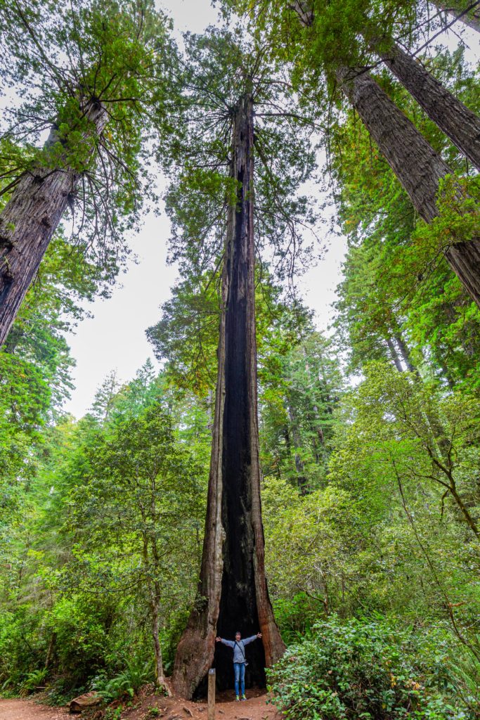
They block the sun, so the other trees and brush on the ground below are not as heavy as in other forests, with lots of shade and ferns. When there were not any loud mouths around it was very peaceful. (We’ve been disturbed several times in various National Parks by people having very loud conversations while wandering the parks. By loud I mean we can hear them almost a minute before we can see them. We’ve also passed people who are generously sharing their music choices by listening via their phone speaker) Pictures really don’t do theses towering trees justice; they are truly amazing. The “Big Tree” is the most popular site, at 1500 years old, 286 feet tall, and 74 feet around, it is actually pretty short when the tallest trees are 380 feet tall. Redwood is a pretty small national park and one day is all you need.
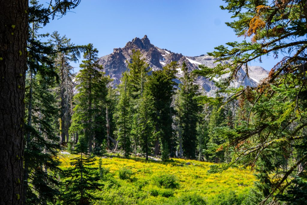
Heading inland, Lassen Volcanic National Park was about an hour from Redding where we parked. Lassen Peak is the largest plug dome volcano in the world, and the park is one of the few places in the world that contains all four types of volcano, dome, cinder cone, shield and strato. The Lassen volcanic area is still active with boiling mud pots, fumaroles and hot springs, and is ranked as a “very high threat” by the USGS volcano observatory. Unfortunately, the most popular trail to see this area, Bumpass Hell, was closed for rehabilitation. It was named after the man who first explored the area, who slipped into a boiling mud pot leading to the loss of his leg. We rode the motorcycles to the park, and were shocked by how freezing cold it was. I stupidly wore my summer weight jacket, and even though I added chaps and a hoodie it was super cold. We did a bit of hiking along a rushing creek to a view of the peak across a flower covered meadow. While the ride was great, the park was a bit underwhelming (Yellowstone is much better for fumaroles), so when we got to the end of the park road we opted to change our plan and instead of riding back through the park, we took the warmer (lower elevation) roads home. It was a great ride to an ok park that would not make our must-see list, but it’s another check mark on our National Parks list.
Sacramento, capital of California, was our next stop, and I was surprised to find the landscape along the drive flat, brown and a lot like Texas. I always think of California as beautiful and green. Sacramento was nice, but the drive here was not pretty. I was glad to be back in a city and the RV park had a pool (one of the first this summer) and weather warm enough to enjoy it. We shopped and went to movies and mostly just enjoyed not sightseeing (we had been “out in nature” for 2 weeks, and we were both looking for a little quiet civilization), except for a day when we rode our bicycles around the downtown area to see the points of interest. The highlight of our stop, we had friends fly in for brunch on our last day (Brian is a private pilot and is often looking for an excuse to fly – brunch and catching up was great!)
This trip was our second attempt to go to Yosemite, having missed it in 2015 when we were in California. We knew the twisting mountain road to get to the RV park was going to be challenging when we started out, and we knew that past the park it was restricted to vehicles under 45 feet, but we were surprised when about twenty miles from the park we started seeing warning signs. Feeling uncertain about it, we kept going for twelve more miles, passing more warning signs, until we came to a small turnout with a sign that said “Last Turn Around – No Vehicles Longer Than 45 Feet” (and indicating a several hundred dollar fine). We pulled over, not sure there was even enough room for us to turn around and decided to unhook the truck and drive the last 8 miles without the trailer. At the park we were told “not to worry because lots of people do it and he had never heard about anyone getting a ticket”. We discovered we would need to navigate a stretch of one lane road with two skinny one lane bridges at each end (and a fairly sharp turn off the bridge onto the one lane road). After driving across the bridges four times, checking the angles, watching buses cross, and timing the lights that controlled the flow, we decided not to risk getting stuck on the bridge (or on the one way road before the light changed) and causing a huge traffic problem if we did not make it. An hour later, back at the trailer we hooked up and managed to turn around, but now we needed an alternate RV park and we had no cell service. We drove to the nearest town to get signal, and found a park another hour away, in Chowchilla, CA. As it turned out, it was a very nice park with a good pool (it also included green fees at the golf course across the road but unfortunately we didn’t have time or clubs).
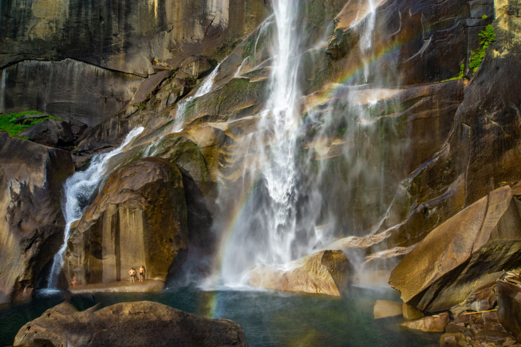
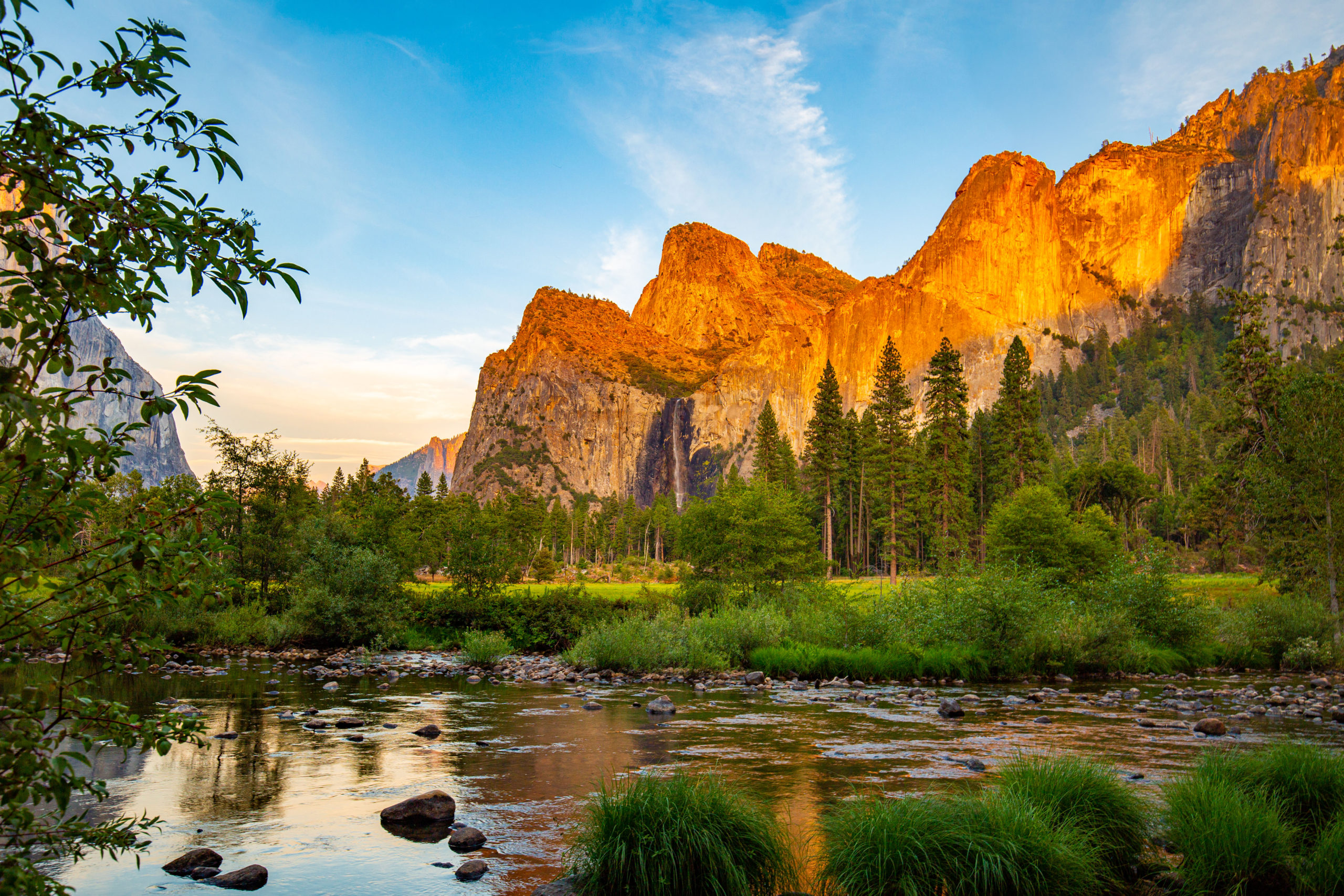
This meant we would have to drive three-hours roundtrip back and forth to Yosemite, which we did once in the truck and a second time on the motorcycles since it was such a nice and curvy road. The park was crowded, but we saw Bridalveil Falls, El Capitan (a giant rock), Yosemite Falls (or what would have been Yosemite Falls if there was any water flowing). The best thing was climbing to the top of Vernal Falls. Only 2.3 miles round trip, it has a strenuous elevation gain of 1000 feet, but it was worth the effort. At .8 miles, after climbing 400 feet, you reach a foot bridge which has a rather disappointing view of the falls stretching away into the distance, so we hiked the next .4 miles and the next 600-foot elevation gain. That is a 28% grade. At the crest the water fell so powerfully it made loud cracking sounds like it was breaking the rocks or like a glacier breaking. Climbing out onto the rocks, we could see where the water fell into a deep pool and rainbows were visible in the mist. There were of course some crazy guys diving into what must have been freezing cold water and the mist was so heavy we were getting soaked just standing nearby. It was stunning! (although there was still more hiking and climbing that we could do to get to the top of the next upper fall, we decided to turn around – we’ve found that looking down a waterfall is generally less impressive than looking up at one).
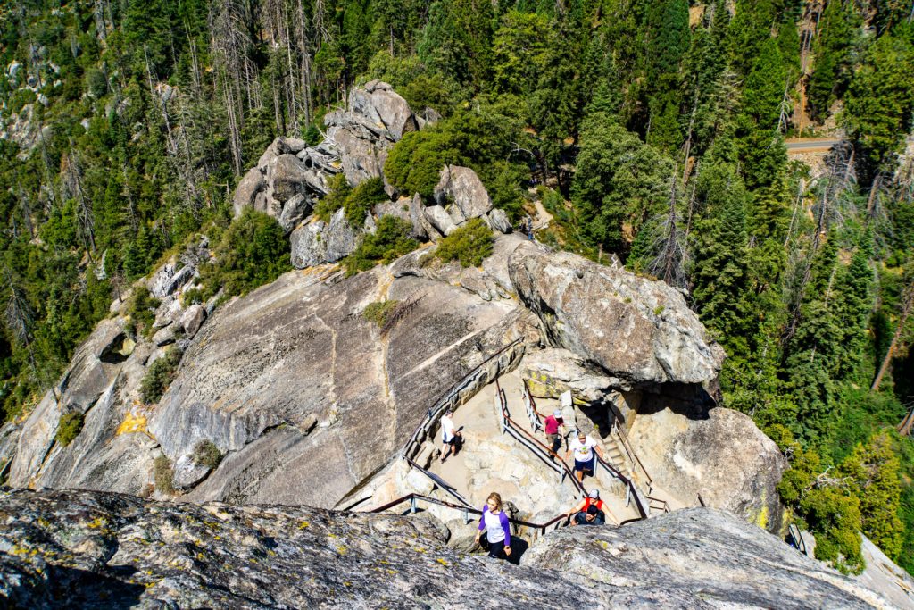
Sequoia National Park was our next destination, but this time Bill carefully checked the route and discovered there was another section of road that restricted long vehicles due to narrow roads and sharp curves (you’d think that the park would tell you that your RV is too long to drive legally on the roads to their park, but that would cost them money so instead they send you an email saying drive carefully). Again, we revised the plan to stay at a RV park farther away, this time in Lemon Cove, CA where there really were lemon tree groves covered in fruit. Since a road that was bad for the RV is exactly what we want for the motorcycles, we saddled up to ride to Sequoia (on the ride, we came on an RV about 10 ft shorter than ours and several times he needed to cross onto the other side of the road to get around the sharp turns. Drive carefully was the recommendation???). We hiked to General Sherman, the biggest tree on earth (by volume), at 103 feet around, 275 feet high, and 2200 years old, it is 1000 years younger than the oldest sequoia. We also climbed Moro Rock, 400 steps up, for great views of the valley. Fortunately, the temps were in the sixty’s, so we were comfortable in our motorcycle clothes and the ride was fantastic.
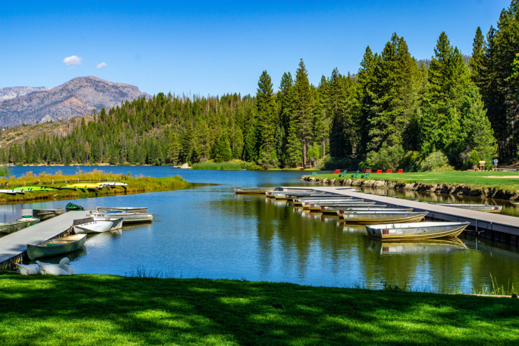
Kings Canyon National Park was over two hours away, in the Sierra Nevada Mountains, but the roads looked too good to waste in the truck, so we rode the motorcycles again. Here they have the General Grant Grove, with the second largest sequoia tree, General Grant, but it is best known for the Generals Highway along the soaring granite walls of the canyon, with the Kings River at the bottom. We rode for many miles along the river and in the foothills before climbing the mountain on roads clinging to the side of the canyon walls. A few short hikes took us to Roaring River Falls and Grizzly Falls, both are probably much more impressive in the spring. After stopping at a Christian Camp on Hume Lake for gas and lunch, we reversed course and rode back down, even more fun than going up. Gotta say, I LOVE my new Indian Scout motorcycle. It is sooo much easier to ride and I feel much safer. I wish I had dumped the HD Sportster years ago.
For our city break from nature, we went to Bakersfield, where California got really ugly, with hundreds of oil rigs pumping away as we drove into town. The RV park was fine, but there was literally nothing to see here, so we just relaxed and made use of the pool, except for one day that we took to drive to 8 of the “Top 10 photo ops in Bakersfield”, all of which were just sad. It is hard to understand why anyone would want to live here and pay the high cost of living in California, it is definitely the butt crack of Cali.
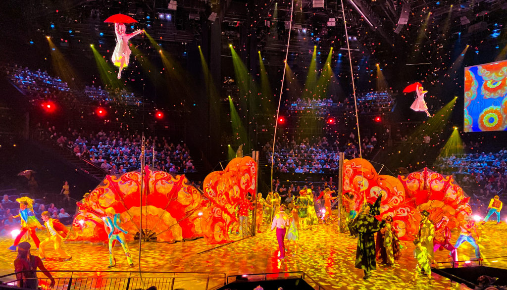
We were supposed to go to Death Valley National Park, but the forecast said it would be 115 degrees (not exactly hiking weather), so we cancelled that and went to Vegas instead. There is a super nice, upscale, RV park called Oasis about 5 miles from the strip. They have 1000 RV sites, a couple of nice pools and it was packed. Only in town for two nights, we booked Beatles Love and Zumanity, the only Cirque shows we had not yet seen. Love was very colorful and Zumanity was funny, with some very heavy ladies in fishnet thongs and bustiers molesting men in the audience. Being big gamblers, we won $5 the first night, then lost $20 (our max) the next. We mostly avoided the overpriced restaurants and overeating at the buffets, but not the burning eyes from casino smokers. Vegas seems better maintained and cleaner than it did in on our last few trips, maybe they have stepped up their efforts to make it more appealing.
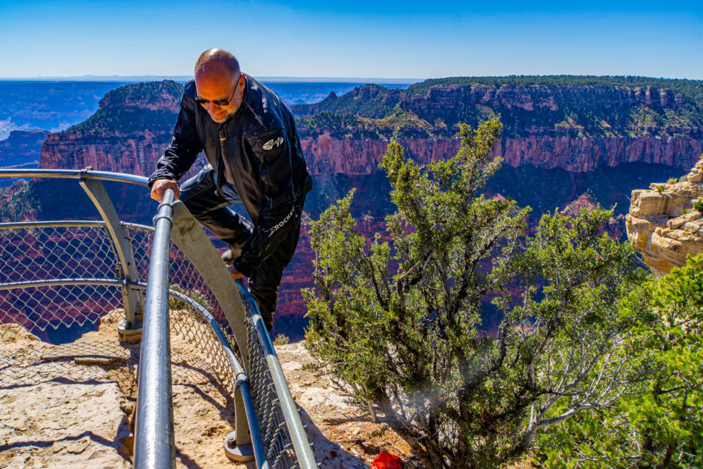
Back to nature, Bill chose Kanab, UT as our base for visiting Zion, Bryce Canyon and the North Rim of Grand Canyon National Park, as well as Antelope Canyon and Horseshoe Bend. We rode the motorcycles to the North Rim since the hikes were fairly short, and it turned out to be a pretty frosty ride. We knew it would be in the upper 50’s at the rim since the elevation was 8,300 feet, but did not realize most of the 200-mile ride was along a crest and the speed limit was 70mph, very chilly. The views were amazing and the winds out on the cliff edges were unbelievably strong… see the pics of Bill climbing over the fence to retrieve his hat after it blew off, isn’t that how people die? (not if they are very careful! and let’s keep in mind that bald people need their hats) The views from this side were amazing, unfortunately, there was a lot of haze, so our pictures are not great. We read a sign in one of the parks that said the haze in the national parks was actually air pollution from as far away as Asia. When we visit such beautiful places, it really impresses us how sad it is that we are doing so much damage to our planet and not nearly enough to stop it.
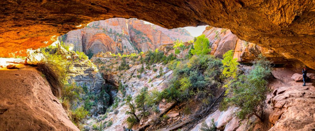
Even with the haze, I was skeptical that the next two parks could measure up to the views of the Grand Canyon, but they did. Zion had a tunnel with narrow lanes on the park road that they managed by stopping traffic to allow wide vehicles like trucks and RV’s to pass, and they charged $15 each way for that service. Since it was much closer, we risked taking the motorcycles again even though the temps were supposed to be even lower than at GC. As it turned out it was much warmer, with beautiful blue skies and we had a great ride. Here at Zion they force all visitors to ride their shuttles to get to most of the sights. It is often annoying (but it eliminates the need for lots of parking lots spread around the park and given the focus is on a canyon there really was no room for parking) but actually worked out fine for us since we were on the bikes and could leave all our gear in the parking lot. This time we were down in the valley with the colorful cliffs above us with several hikes was along the river. At one of the shuttle stops, the park rangers had set up spotting scopes to provide views of some baby Condors.
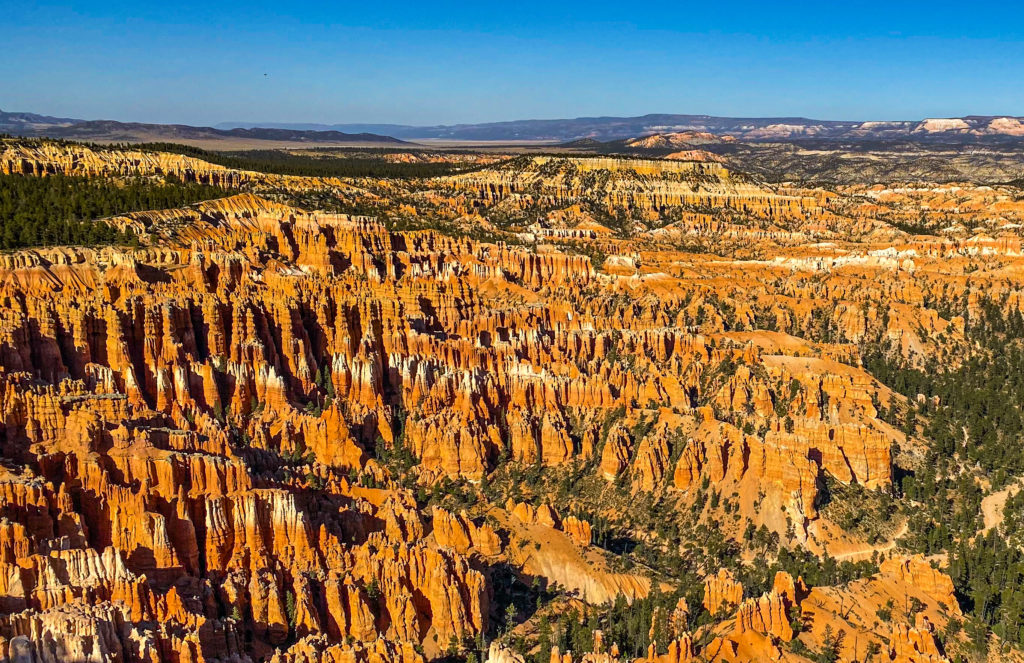
Bryce Canyon National Park is known for its Hoodoos, towering rock formations in many shades of orange, yellow and white. They resemble upside-down icicles, and from the overlooks you can see thousands of them. We climbed from the rim down into the canyon, to hike among the hoodoos and they are even more impressive up close. Of course, this meant we had climb back up a thousand feet, good thing we had cameras to give us an excuse to stop and rest. This park also has vehicle length restrictions, nothing longer than 20 feet and our truck is 22 feet. They let us in but a ranger did warn us that next year they will start measuring. We are unlikely to return, but this was my favorite park of the three in this area, and it should definitely go on your “must see” list.
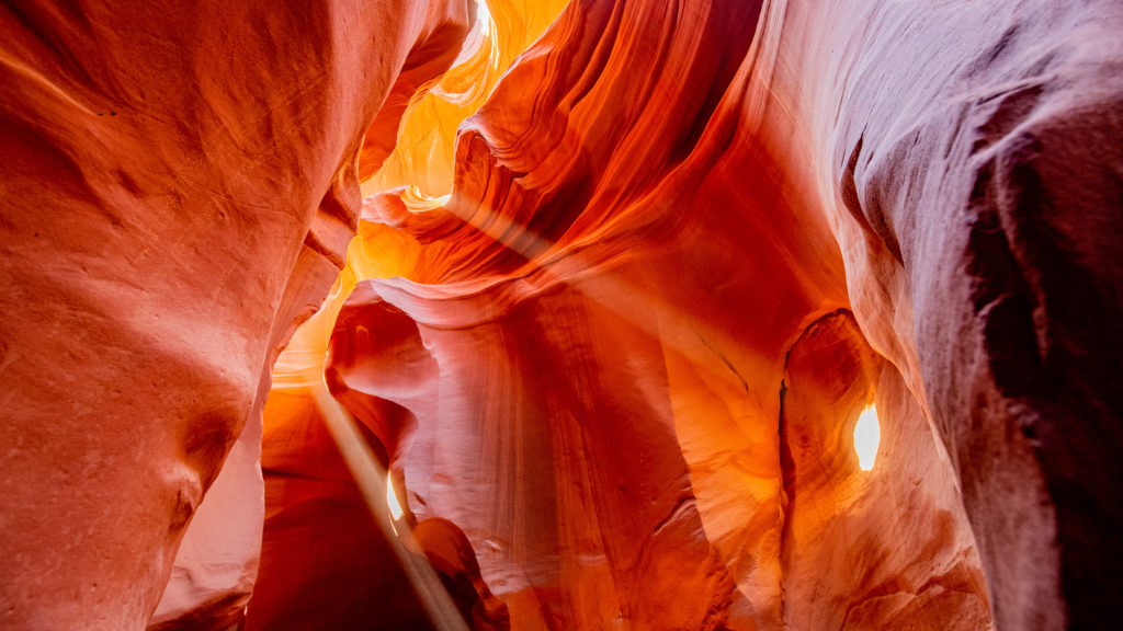
We applied to see The Wave, but the Bureau of Land Management only allows 20 people per day and we were not lucky enough to win a spot through their lottery system, so we booked a tour of Lower Antelope Canyon. The canyon is located on reservation land, about 90 minutes from Kanab, so we got up and left at 8am for our 10:15 reservation, only to discover we were an hour early because they don’t recognize daylight savings time and were still on Mountain Standard Time. I had read the lower canyon was not as crowded as the upper canyon, although all of the tours are 100% sold out during the primo hours. When our group of ten first climbed down the stairs into the canyon we stood in an area about 15 x 15 with at least 50 other people, pressing forward as each group went through. I was very glad it was October and not August because it would have been unbearably hot. When it was finally our turn, it got much better. Each group was allowed to be in each section without the crowd (I was very impressed at how well they had this organized and how smoothly our tour operated. This is very often NOT the case). Our guide was excellent, and she helped us get the best angles for pictures and took several photos of us in this incredibly beautiful canyon. I had picked this particular time slot as it had the best chance to see sun beams passing into the canyon and we were lucky enough to see several. Back in town we had really good ‘Texas’ BBQ at Big John’s, then went to Horseshoe Bend, a crescent shaped bend of the Colorado River. After paying our $10 access fee (it’s on another reservation), we hiked the ¾ mile up to the edge of the cliff for the view from above. There are no rails, and we had to get pretty close to the edge to get a picture of the whole horseshoe, but danger is no barrier for a good photo (I kept a close eye on her Mindy so you don’t need to worry).
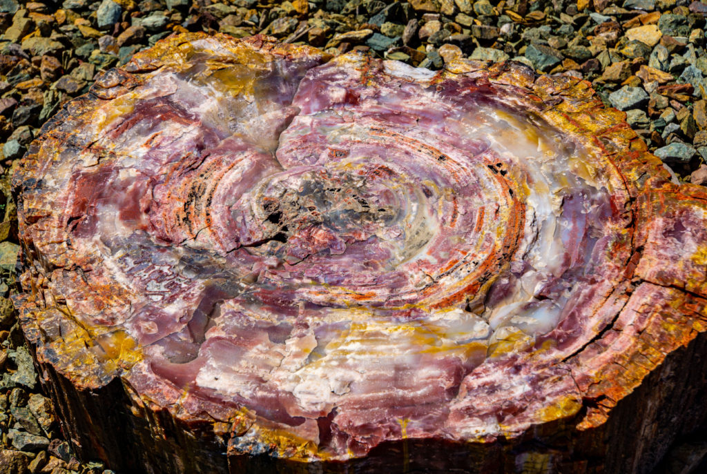
After four straight days of long sightseeing drives and hiking, I was glad for a travel day, but it did not last long. Our last National Park stop was at Petrified Forest. I was definitely tired of exploring and the landscape here was downright ugly. There are scattered logs and sections of logs that have turned into rocks, and they do have many colors in their layers, but the descriptions of the hiking areas were far from accurate. Blue Mesa was not blue, Crystal Forest had no crystals and as a matter of fact, there is no forest at all, it was just gray and brown. I declined to even get out of the truck at the last couple of overlooks. This is a park you should skip (seeing the petrified trees/logs is quite interesting but it is a 20 min activity at most and then it’s time to move on).
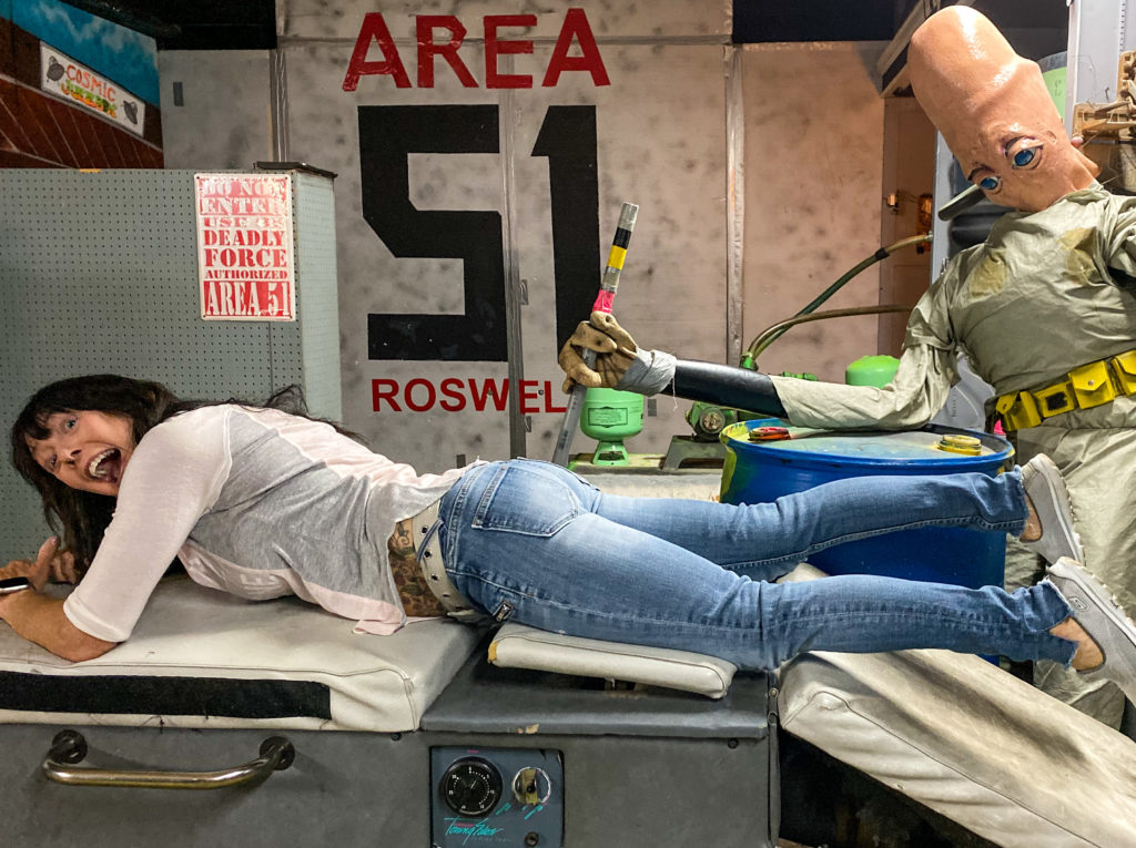
Bill has wanted to stop in Roswell, NM ever since we started traveling and it was our final destination as we headed home. We expected the whole town to be alien themed, but there was actually not much of that to be seen. We went to the International UFO Museum, which I dreaded because Bill likes to read ALL the signs, and I prefer a more cursory style, but he managed to go through it all in about 45 minutes (by not reading everything). Alien Zone was our second stop, a gift shop that has an area set up with various alien scenes that allows visitors to be part of the action. We paid our $10 and entered a seriously grungy back room, where we took some silly pics with the alien dummies. That was all Roswell had to offer…we were done in less than 90 minutes.
500 miles to go and we will be glad to stay home until after Christmas (except for a couple of one week trips, one for my nephew’s wedding and one for a dive trip to Grand Cayman). On this 18-week trip, we have traveled over 5,000 miles pulling the trailer, ridden more than 3,000 miles on the motorcycles, stayed in thirty different cities/RV Parks, two countries, ten states, two provinces, and visited eighteen National Parks (17 US and 1 Canadian). We have been very busy! Next year we plan to return to Florida for the winter months, then after a few weeks at home, we will go to Europe, to visit Germany, Spain, Brussels and Amsterdam.
For now, we wish you all a Merry Christmas!! (and of course, a Happy New Year)
See you in 2020…
See our photos and video here.
Awesome! Thank you for sharing! And Happy Holidays!